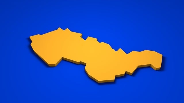
Slovakia, located in Central Europe, is bordered by Austria, Czech Republic, Poland, Ukraine, and Hungary. Slovakia is also in close proximity to southern Poland, a region that extends into the Outer Western Carpathians and was historically part of the Great Moravian Empire. A map of Slovakia in Europe shows its pivotal position connecting Western and Eastern Europe. This guide will delve into Slovakia’s regions, cities, and natural features, providing a detailed look at this diverse country.
Table of Contents
Key Takeaways
Slovakia’s central location in Europe fosters significant cultural and economic interactions, influencing its historical development.
The country is divided into several distinct regions, each with unique characteristics and major cities that contribute to Slovakia’s cultural diversity.
During World War II, Slovakia became a puppet state under Nazi Germany, which implemented oppressive policies against the Jewish population and faced eventual resistance leading to the Slovak National Uprising.
Integration into the European Union has prompted infrastructural improvements and sustainability initiatives, enhancing Slovakia’s economic resilience.
Slovakia’s Location in Central Europe
Slovakia is a landlocked nation situated in the heart of Central Europe, making it a crossroads of various cultures and trade routes. Its central location has profoundly influenced its history, fostering a rich tapestry of cultural exchanges and economic interactions. Independent Slovakia shares its borders with five countries: the Czech Republic and Austria to the west, Poland to the north, Ukraine to the east, and Hungary to the south, positioning it as a pivotal hub in Central Europe.
The country’s strategic location has historically made it an important center for transportation and cultural interactions within the region. Slovakia’s landlocked nature enhances its trade dynamics, often necessitating strong diplomatic and economic ties with its neighboring countries. Historically, much of modern-day Slovakia was part of Hungarian territory, especially during the medieval period, which further influenced its cultural and political landscape. This interconnectedness is a defining characteristic of Slovakia’s role in the broader European landscape.
Most Slovaks have a deep appreciation for their nation’s geographical position, recognizing it as a bridge between Western and Eastern Europe. This unique placement has cultivated a diverse cultural heritage, blending influences from the Slavic, Hungarian, and Austrian traditions. As we delve further into the detailed map of Slovakia, we’ll see how these geographical and cultural factors shape its regions and cities.
Slovakia on the European Map: Slovakia Map
A map of Slovakia immediately highlights its strategic position in Central Europe and Central and Eastern Europe. A slovakia map shows Slovakia’s borders with:
Poland to the north
Hungary to the south
Ukraine to the east
Austria to the southwest
the Czech Republic to the west
This location carries historical and cultural significance.
Maps of Slovakia often include a variety of features that make them indispensable tools for education and exploration. These maps typically display country boundaries, major cities, prominent mountain ranges, and important rivers. For instance, a laminated map of Europe will showcase not only Slovakia’s borders but also its key physical and political features, including major lakes, rivers, and roads.
Educational and decorative uses of Slovak maps are quite common. They serve as valuable resources for students and educators, providing a visual context for understanding Slovakia’s geography and its place within Europe. Additionally, these maps can be aesthetically pleasing additions to any space, often used for display in homes and offices to highlight Slovakia’s unique location and features.
Seeing Slovakia on a European map contextualizes its role within the continent. It underscores the country’s historical ties with its neighbors and its ongoing integration into the broader European framework. Next, the regional maps of Slovakia will be examined to understand the specific areas that make up this fascinating country.
Geography and Climate of the Slovak Republic
Relief and Drainage
The Slovak Republic, nestled in Central Europe, boasts a diverse and picturesque landscape. Dominated by the Western Carpathian Mountains, Slovakia’s terrain is a blend of towering peaks, rolling valleys, and expansive lowlands. The High Tatra Mountains, part of this range, are particularly notable, featuring the highest elevations in the country. These majestic mountains not only define Slovakia’s topography but also serve as a natural border to the east, while the Little Carpathian Mountains form a natural boundary to the west.
Slovakia’s intricate drainage system is shaped by several significant rivers. The Danube River, one of Europe’s major waterways, flows through southern Slovakia, playing a crucial role in the middle Danube region’s trade and transportation. Other important rivers include the Váh, Hron, and Bodrog, each contributing to the country’s rich hydrological network. These rivers, originating from the mountainous regions, traverse the valleys and lowlands, supporting agriculture and providing vital resources for the population.
Climate
Slovakia experiences a temperate climate, characterized by distinct seasonal variations. Winters are cold, particularly in the mountainous regions, where temperatures can plummet to around 25 °F (−4 °C) in the High Tatras. In contrast, the Danubian lowlands enjoy warmer summers, with average July temperatures exceeding 68 °F (20 °C). This continental climate, influenced by Slovakia’s easterly position, results in significant temperature differences between the seasons.
Precipitation patterns in Slovakia vary across the country. The Danubian plains receive about 22 inches (570 mm) of annual rainfall, while the windward mountain valleys can see more than 43 inches (1,100 mm). July typically brings the highest rainfall, whereas January is the driest month. These climatic conditions, combined with the diverse topography, create a rich and varied environment that supports a wide range of flora and fauna.
Regional Maps of Slovakia
Slovakia is divided into several distinct regions, each with its own unique characteristics and historical significance. These regional maps offer a closer look at the diverse landscapes and cultural hubs that define the Slovak Republic. Understanding these regions provides a deeper appreciation for the country’s rich heritage and geographical diversity.
Nitra, located in western Slovakia, is known for its historical significance in early Christianity and its role as an agricultural hub. With a population of 80,524, Nitra boasts a blend of historical and modern attractions, including its well-preserved Baroque architecture and the iconic Nitra Castle. This region’s agricultural prowess is a testament to its fertile lands and strategic location.
Žilina, in central Slovakia, stands out as a key center for international manufacturing. With a population of 108,114, Žilina is also known for its unique Slovakian architectural designs, which reflect the region’s rich cultural heritage. The city’s blend of industrial and historical significance makes it a vital part of Slovakia’s economic landscape.
Košice, located in eastern Slovakia, is the administrative center and the country’s second-largest city, with a population of approximately 355,047. Košice is renowned for its historical sites, including medieval buildings and modern architecture, reflecting its role as a cultural and economic hub.
Prešov, another important city in eastern Slovakia, is characterized by its diverse architectural styles and rich historical background. Collectively, these regions illustrate Slovakia’s geographical and cultural diversity.
Major Cities in Slovakia

With a population exceeding 5 million, Slovakia is home to several major cities that serve as cultural and economic centers, preserving the nation’s history and heritage. These cities provide a glimpse into Slovakia’s vibrant urban life and its architectural grandeur.
The capital city, Bratislava, is the largest city in Slovakia and a vital cultural and economic hub. Situated in western Slovakia, Bratislava is known for its rich historical architecture, including the Bratislava Castle and St. Martin’s Cathedral. The city’s vibrant cultural scene, with numerous museums, theaters, and galleries, makes it a focal point for both locals and tourists.
Nitra, one of the oldest towns in Slovakia, is notable for its historic castle and well-preserved Baroque architecture. Trnava, recognized as the oldest town in Slovakia, boasts the highest number of churches in the country, showcasing its Baroque architecture. Trenčín, admired for its picturesque castle overlooking the Váh River, adds to the historical charm of Slovakia’s towns.
Košice, the second-largest city in Slovakia, is distinguished by its mix of medieval and modern architecture. Košice in eastern Slovakia exemplifies the country’s historical depth and contemporary dynamism. Together, these major cities highlight the diverse urban landscape of Slovakia, each contributing to its unique cultural mosaic.
Natural Borders and Features
Slovakia’s natural landscape is a tapestry of mountainous terrains, lush forests, and significant rivers. The country’s geography is predominantly mountainous, characterized by ranges such as the Ore Mountains and the Carpathians. These natural features not only define Slovakia’s topography but also influence its climate and biodiversity.
The Tatra Mountains, which lie within Slovakia, are home to the highest peak in the country, Gerlach Peak, standing at an impressive 2,665 meters. This majestic mountain range is a natural border with Poland and is a popular destination for hikers and nature enthusiasts. The Tatra Mountains are not just a geographical landmark but also a symbol of Slovakia’s natural beauty.
The Danube River, flowing through southern Slovakia, is the largest river in the country, spanning 172 kilometers of its territory. This river is a crucial natural feature, forming fertile lowlands and serving as a major waterway for trade and transportation in the middle danube region. The Danube’s presence significantly impacts the surrounding regions’ agriculture and economy.
Forests cover approximately 40% of Slovakia’s land area, providing crucial habitats and contributing to the region’s biodiversity. These forests, along with the country’s temperate continental climate, create a diverse ecological environment. Recognizing Slovakia’s natural borders and features provides insight into its geographical and environmental significance.
Rivers and Lakes of Slovakia
Rivers and lakes are vital to Slovakia’s natural landscape, significantly impacting its ecology, economy, and daily life. Among the major rivers are the Váh, Hron, Hornád, and Bodrog, each contributing to the country’s intricate river system.
The Váh River stands out as the longest river in Slovakia, formed by the joining of the Black and White Váh Rivers. It flows southward, eventually meeting the Danube River, and is a key waterway for the regions it traverses. The Hron River is another significant river, winding through central Slovakia and supporting various agricultural and industrial activities.
Slovakia’s natural lakes and reservoirs, though small, play important roles in water storage and flood prevention. These water bodies, alongside the rivers, are integral to the country’s hydrological system, supporting both environmental and human needs. The lowest point in Slovakia is near the Bodrog River, at an altitude of 94 meters above sea level, highlighting the diverse topography of the region.
Historical Maps of Slovakia

Historical maps of Slovakia offer a window into the past, revealing the evolution of its borders and territories. During the period of Great Moravia, maps display fluctuating boundaries, especially under the rule of notable leaders like Svatopluk I, who expanded the state’s territory to its maximum extent. These maps are crucial for understanding the historical context of Slovakia’s development.
Google Earth provides an invaluable resource for exploring historical imagery layers, allowing users to witness the changes in Slovakia’s landscapes over time. This digital tool enhances our ability to visualize historical shifts and understand the geographical transformations that have shaped modern Slovakia.
Historical maps and territorial changes are crucial for understanding present-day Slovakia. These maps not only document the past but also provide insights into the cultural and political dynamics that have influenced Slovakia’s current borders and regions.
History of Slovakia
Early History and the Slovak Socialist Republic
The history of Slovakia is a tapestry woven with influences from various empires and cultures. Dating back to the 11th century, the region now known as Slovakia was under Hungarian rule. The ancestors of modern Slovaks were often referred to as inhabitants of Upper Hungary or “the Highlands,” reflecting their geographical and cultural identity rather than their Slavic language.
In the 19th century, the Slovaks began to forge a distinct national identity, drawing inspiration from the 9th-century Slavic kingdom of Great Moravia. This period saw the creation of a heavily mythologized narrative that linked the Slovak people to this ancient kingdom, fostering a sense of historical continuity and pride.
Slovakia emerged as a geopolitical entity in 1918, when it became part of the newly formed Czechoslovakia. This union marked the beginning of a new chapter in Slovak history, characterized by significant political and social changes. After World War II, Czechoslovakia fell under Soviet influence, and Slovakia became part of the Slovak Socialist Republic. This era of communist rule, lasting from 1948 to 1989, was marked by significant economic and political transformations.
The Velvet Revolution of 1989 brought an end to communist rule, paving the way for Slovakia’s independence in 1993. Today, Slovakia is a parliamentary democratic republic, proudly standing as a member of the European Union and NATO. This journey from a region under Hungarian control to an independent nation within the European framework highlights Slovakia’s resilience and adaptability through the centuries.
Learn more, Slovakia | History, Map, Flag, Population, Language …
Slovakia in the European Union
Slovakia’s integration into the European Union has brought about significant developments in its infrastructure, policies, and economic resilience. One of the key initiatives is the REPowerEU plan, which focuses on reducing dependency on fossil fuels and enhancing energy security. This initiative is part of Slovakia’s broader strategy to align with EU sustainability goals.
To foster digitalization, Slovakia is investing in e-government solutions and digital skills training for businesses and education. These efforts are aimed at modernizing the country’s administrative processes and enhancing its competitiveness within the European Union.
The impact of EU integration on Slovakia’s infrastructure is evident in the improvements in transportation networks, energy systems, and public services. These developments reflect Slovakia’s commitment to enhancing its economic resilience and competitiveness within the European framework.
Various investment projects under the EU recovery plan further demonstrate Slovakia’s commitment to enhancing its economic resilience and competitiveness. These initiatives are designed to create a more robust and sustainable economy, aligning with the broader objectives of the European Union.
Environmental Concerns and Natural Hazards
Slovakia faces several environmental challenges, primarily stemming from industrial activities. Air pollution, a significant concern, is largely caused by emissions from metallurgical plants. This pollution has led to phenomena such as acid rain, which damages forests and other natural habitats. Addressing these issues is crucial for preserving Slovakia’s rich biodiversity and ensuring a healthy environment for its residents.
Natural hazards also pose a threat to Slovakia. Flooding is the most frequent disaster, exacerbated by the country’s varied topography and climatic conditions. Other hazards include wildfires, extreme temperatures, and storms, all of which have become more pronounced with changing climate patterns. Mitigating these risks is essential for protecting communities and infrastructure.
In response to these environmental and natural challenges, Slovakia’s recovery plan allocates a substantial portion of its budget to sustainability initiatives. Approximately 46% of the plan’s budget is dedicated to combating climate change, including 64 investment projects aimed at enhancing climate objectives and creating a more sustainable economy. These efforts reflect Slovakia’s commitment to a greener, more resilient future.
Explore Slovakia with Google Earth
Google Earth is a fantastic tool for exploring Slovakia’s diverse geography from home. This free program allows users to view detailed satellite images of Slovakia, showcasing its topographical features, including mountains, valleys, and rivers. Whether you’re using a desktop, tablet, or mobile phone, Google Earth provides an immersive experience of Slovakia’s natural beauty.
One of the most compelling features of Google Earth is the ability to see detailed images of houses, vehicles, and even people in Slovakia. This level of detail brings the country’s landscapes to life, offering a virtual tour that can complement any travel plans or educational projects. Users can also save their favorite locations as ‘placemarks,’ making it easy to revisit these spots in future sessions.
Using Google Earth to explore Slovakia is both easy and highly educational. It offers a unique way to appreciate the country’s geographical diversity and historical sites. By virtually traversing Slovakia’s regions, one can gain a deeper understanding of its cultural and natural heritage.
Educational and Decorative Maps
Maps of Slovakia are versatile tools, serving both educational and decorative purposes. Handcrafted wooden maps, for instance, showcase the various districts along with their names, towns, and villages. Made from durable poplar wood and featuring a single-layer design, these maps are ideal for schools and home teaching, emphasizing their educational value.
These wooden maps are not only functional but also aesthetically pleasing. They make excellent gifts for those interested in geography or Slovak heritage. High-quality clip art maps of Slovakia are also available for commercial use, offering detailed and blank options for educational or decorative purposes. These maps can enhance learning experiences and add a touch of elegance to any space.
Decorative maps can include artistic representations such as silhouettes of Slovakia or maps styled with flag effects. These artistic maps add aesthetic value to homes, offices, or classrooms while serving as a reminder of Slovakia’s rich cultural and geographical landscape. Educational maps, in particular, are instrumental in fostering a deeper understanding of Slovakia’s geography and history.
Summary
Exploring the detailed map of Slovakia reveals a country rich in history, culture, and natural beauty. From its strategic location in Central Europe to its major cities and natural features, Slovakia offers a unique blend of historical significance and modern-day allure. The country’s rivers, lakes, and mountainous terrains contribute to its diverse ecological landscape, while its integration into the European Union highlights its evolving role in the region.
Understanding Slovakia through its maps, whether historical or modern, provides valuable insights into its past and present. The educational and decorative maps serve as tools for learning and appreciation, while platforms like Google Earth offer a virtual exploration of Slovakia’s geography. These resources together paint a comprehensive picture of a nation that is as intriguing as it is beautiful.
Frequently Asked Questions
Where is Slovakia located?
Slovakia is a landlocked country in Central Europe, bordered by the Czech Republic, Austria, Poland, Ukraine, and Hungary.
What are some major cities in Slovakia?
Major cities in Slovakia include Bratislava, Nitra, Trnava, Trenčín, and Košice, each contributing to the country’s rich historical and cultural landscape.
What are the natural features of Slovakia?
Slovakia is characterized by its stunning natural features, including the Tatra Mountains with Gerlach Peak, the Danube River, and extensive forests that cover approximately 40% of the country. This diverse landscape contributes to Slovakia’s rich biodiversity and scenic beauty.
How does Slovakia address environmental concerns?
Slovakia addresses environmental concerns by prioritizing sustainability in its recovery plan, which dedicates funds to combat climate change and improve energy security. This proactive approach reflects a commitment to preserving the environment for future generations.
Can I explore Slovakia virtually?
You can indeed explore Slovakia virtually through Google Earth, which offers detailed satellite imagery and the option to save favorite locations as ‘placemarks’. This allows for an immersive exploration experience from the comfort of your home.


